SILVICULTURE:
Planting - Plantation & Native re-vegPruningFertilising
FirefightingWeed control - Aerial and ground
RESEARCH & MONITORING:
Trial establishment
Trial measurement
Foliage sampling
Seed collection
Sirex identification & management
PLANNING & HARVESTING:
Drone mapping
Boundary mapping
Wildlife surveys
Wildlife consultation & management
Koala spotting & management
Traffic ManagementPowerline Spotting
RESOURCE MANAGEMENT:
Inventory & MeasurementSelective thinning
GIS Plantation bounday mapping
Survival & stocking count


.png)
SPECIALIST SERVICES:
Wildlife surveyingWildlife management & consultationAgricultural 'spray' drone servicesAerial imagery & mapping
WILDLIFE SURVEYING
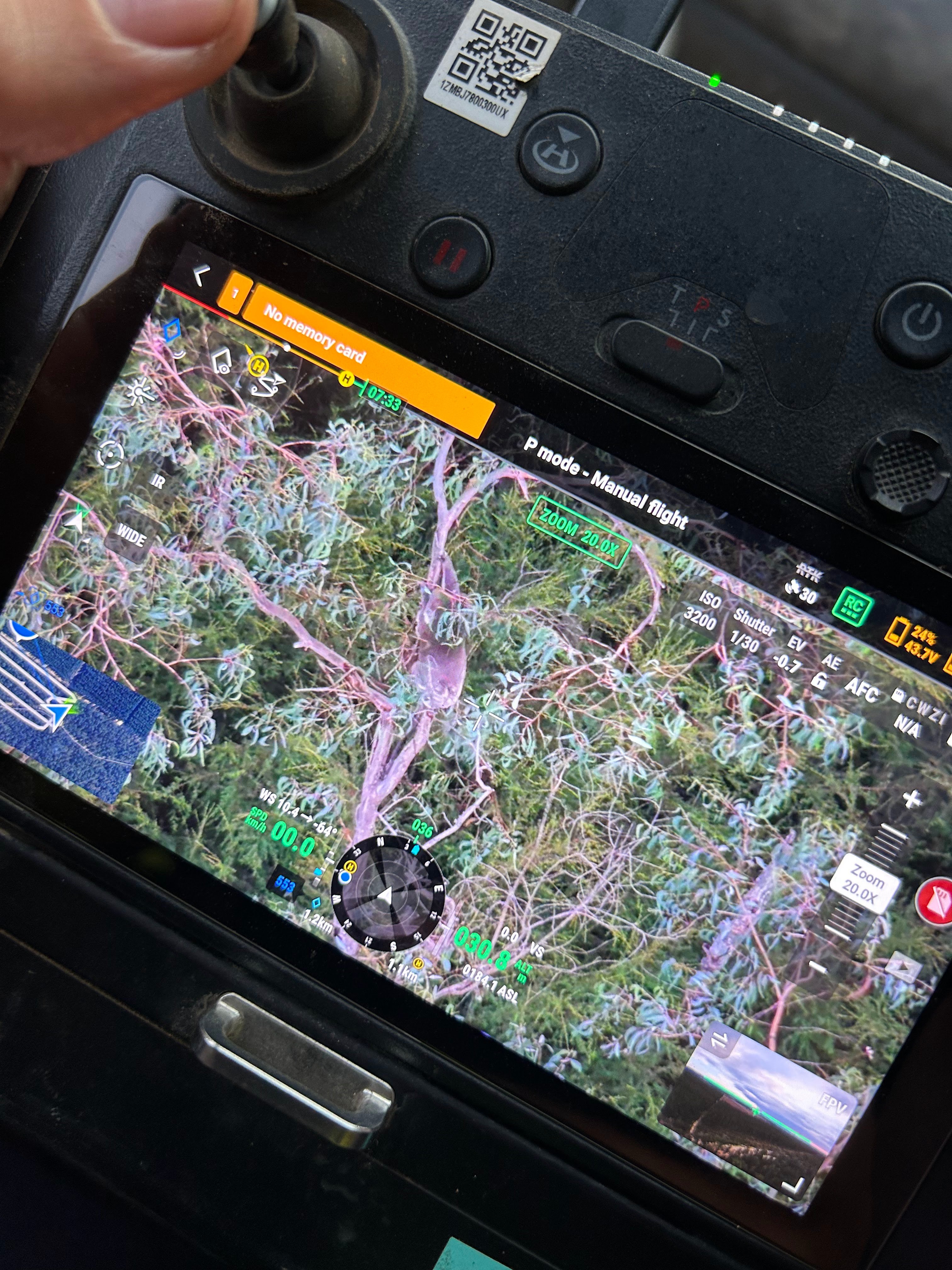
Equipped with the most advanced drones, cameras and featuers available, we are the industry experts in thermal wildlife surveying in forests and plantations. Our survey skills are utlised every single working day in plantations across victoria. We have a fleet of Matrice 300 RTK and Matrice 350 RTK airframes fitted with H20N & H30T thermal cameras, with the addition of spotlight payload capabilities. Our experienced team are also highly capable of a range of ground based survey and monitoring techniques
We have completed surveying and monitoring projects for all of the following species:
- Koalas
- Greater gliders & other arboreal mammals
- Kangroos & Wallabies
- Deer
- Bats
- Owls
AGRICULTURAL DRONe spraying
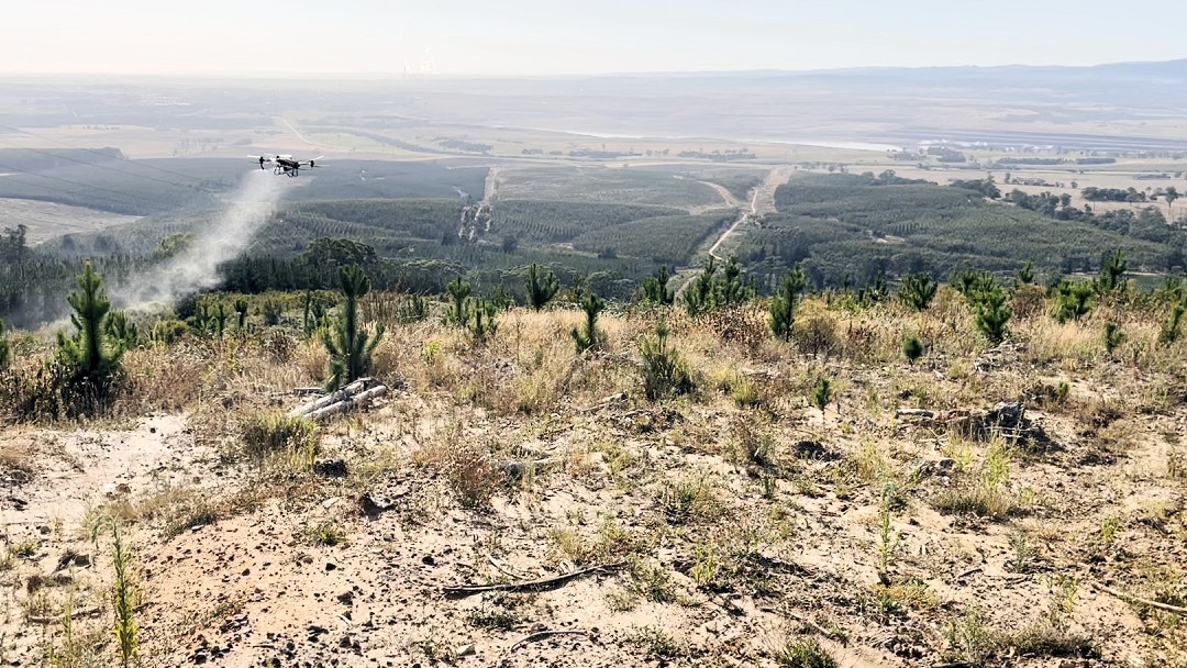
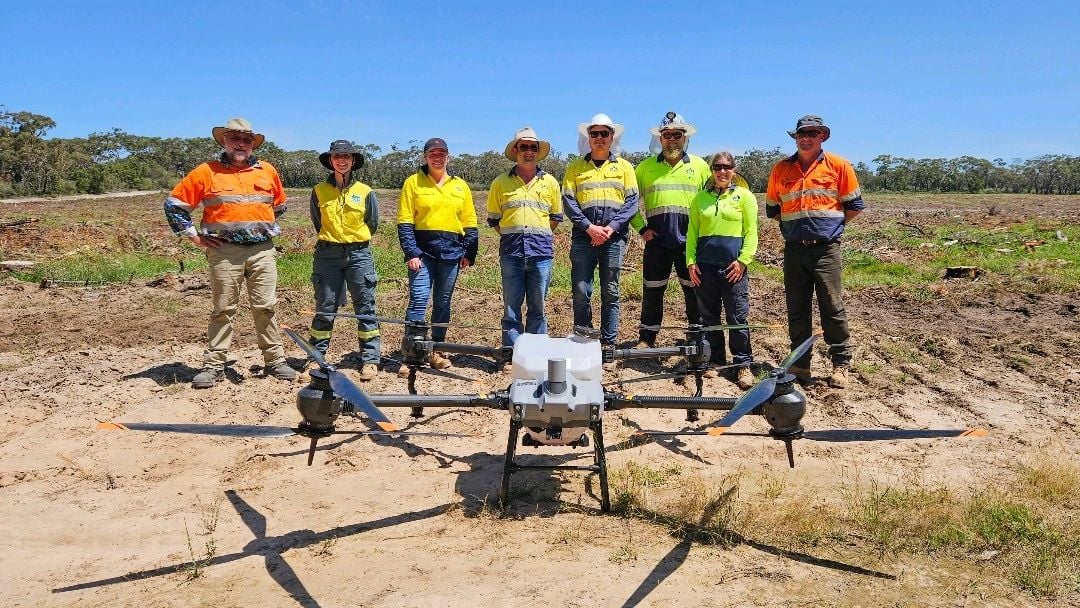
Precision treatments
Spray drones provide a fantastic way to manage difficult sites, capable of incredibly challenging terrain around all manner of obstacles all while offering remarkable precision.
Spraying
Broadacre, Spot and variable rate spraying of herbicides, insecticides, fungicides, fertilisers & soil treatments
SPREADING
Granular and dry matter spreading incl herbicides, fertilsers, soil treatment & baits
SEEDING
Dry seed distribution such as grasses and cover crops
We are able to safely and efficently naviagte around powerlines, wet areas, remanant trees and other site hazards. With our comprehensive range of drones including DJI AgrasT20, T40, T25 & T50, we have a setup to suit every type of terrain and application EXPERIENCED - LICENCED - INSURED REOC: 6714 COL: 1054 AAOL: 1300081
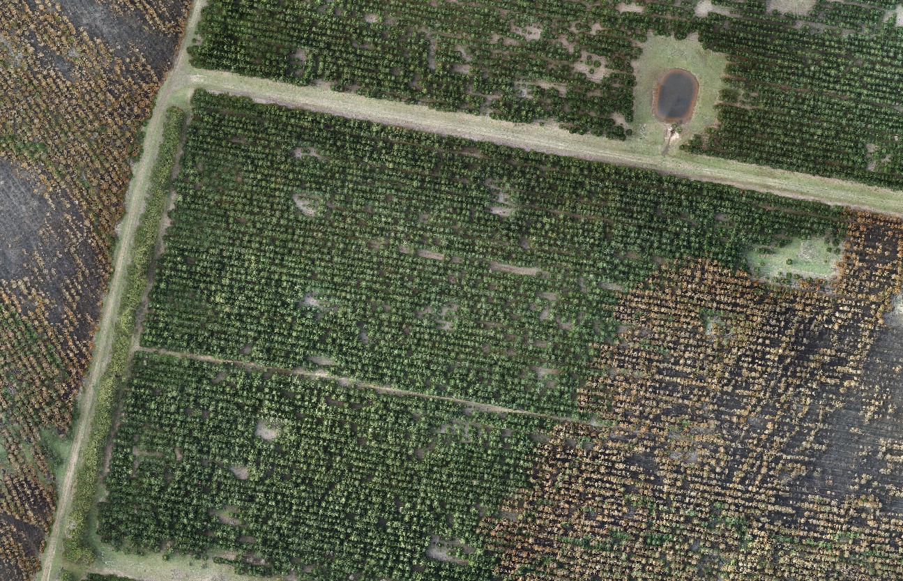
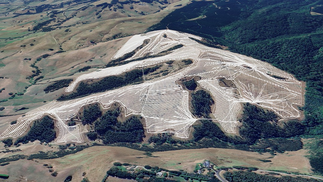
AERIAL MAPPING & IMAGERY
High quality imaging for all applications
We are equipped to provide high resolution, high accuracy images and orthophotos with our 45MP cameras, GSDs of up to 1.5cm/px available.
Ideal for situations such as:
- Harvest area monitoritng
- Storm & Fire damage assessment
- Operations planning
- Vegetation assessment
- Weed identification & evaluation